
See for yourself where water brought up from the coal seam spilled onto the ground ten years ago. Photographs taken December 2020.
Pilliga Forest Map – Key 4
Visit Plumb Road and Pilliga Forest Way spill sites and government water monitoring bore – 30 minutes to an hour.
Plumb Road
Newell Highway turn west into Plumb Road to see the impacts of coal seam gas extraction on the environment.
When wastewater brought up from the coal seam is not contained, all plants in the spill area die. Over 20 wastewater spill sites exist in the Pilliga Forest. In an attempt to rehabilitate these sites, Santos’ contactors spread gypsum and sulphur over the area. Thick irrigation hoses water the site to dilute the salt and flushed it down to creeks and possibly into the Great Artesian Basin. This spreads the salt and toxins well beyond the initial spill area. The gypsum breaks up the salt and helps it float away, and the sulphur brings the pH back from alkaline towards acid. Spill areas are later covered with woodchip, supposedly from local native trees. Then new trees are planted with plastic tree guards, but they usually die when their roots reach the salt, so they are planted again and again.
When wells no longer produce gas they are decommissioned, that is plugged and abandoned. The well head infrastructure is removed and a metal plate is attached, so it can be located from the surface.
Driving west along Plumb Road watch out for the following
1. Gas pipeline crossing
The gas is pumped to the Santos owned Wilga Park Power Station near Narrabri.
2. Bohena 4 decommissioned gas well

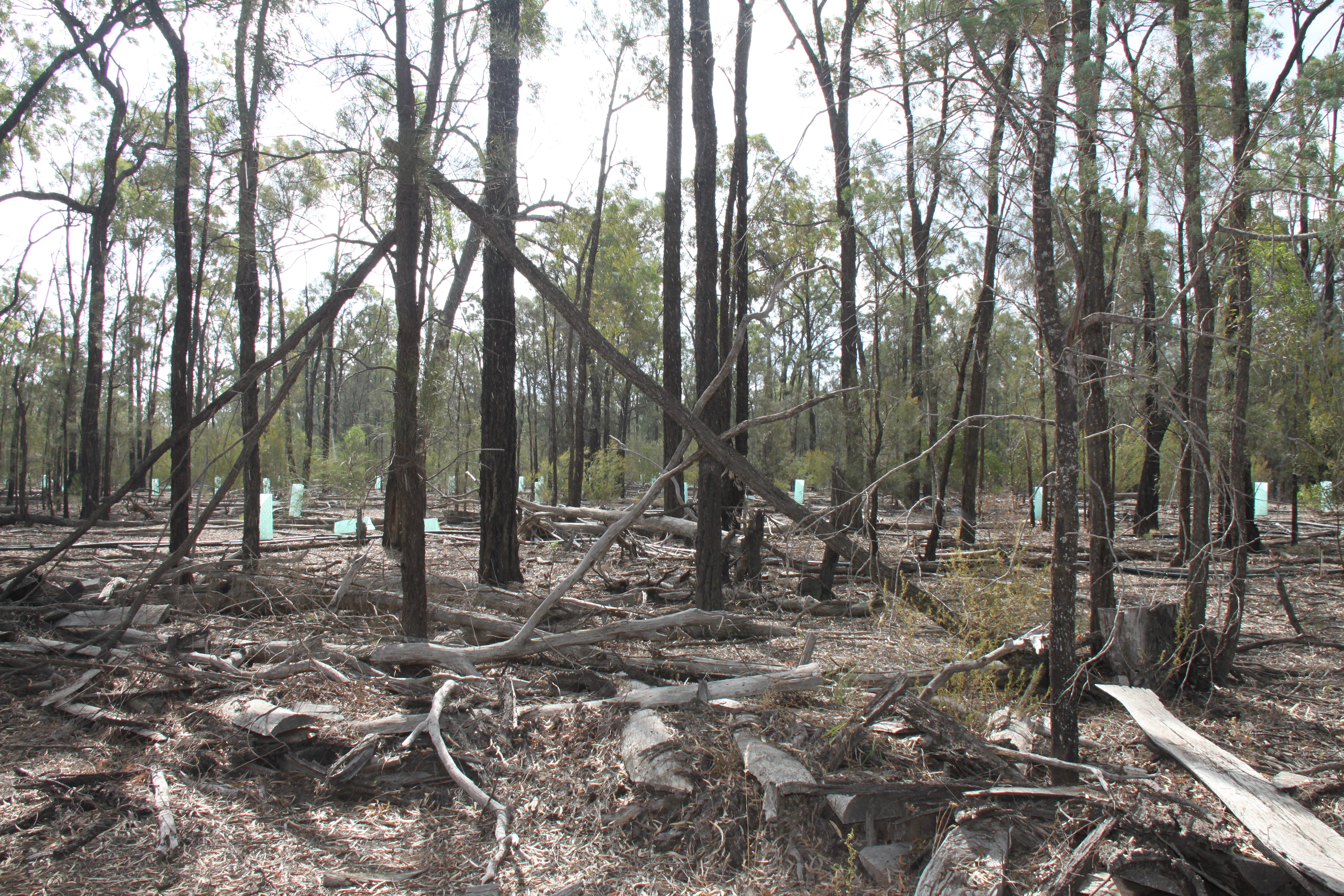
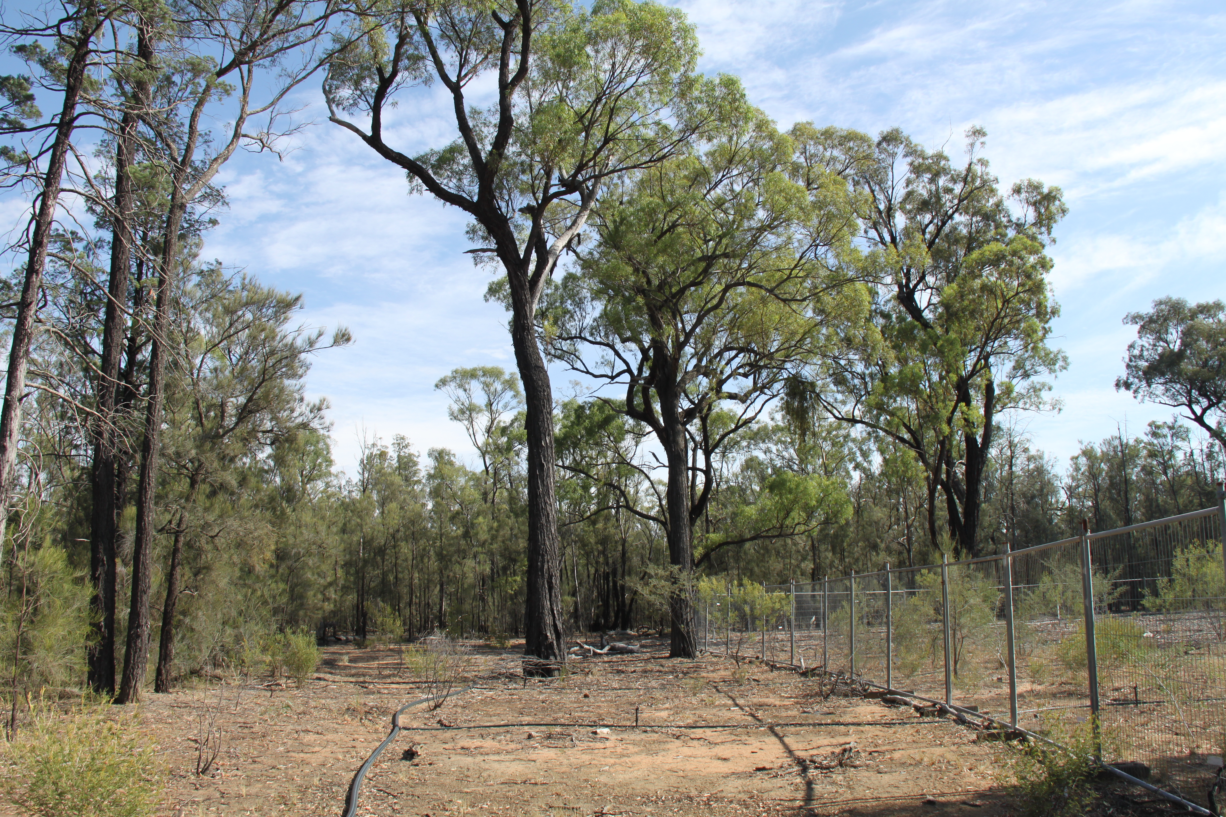
A track going north into the forest leads to a big green water tank, follow the hoses until you come to a spill site. Rehabilitation has one tree species growing, bark covers the ground, but little else grows there. However, prickly pear, a weed grows in the forest.
3. Spill site
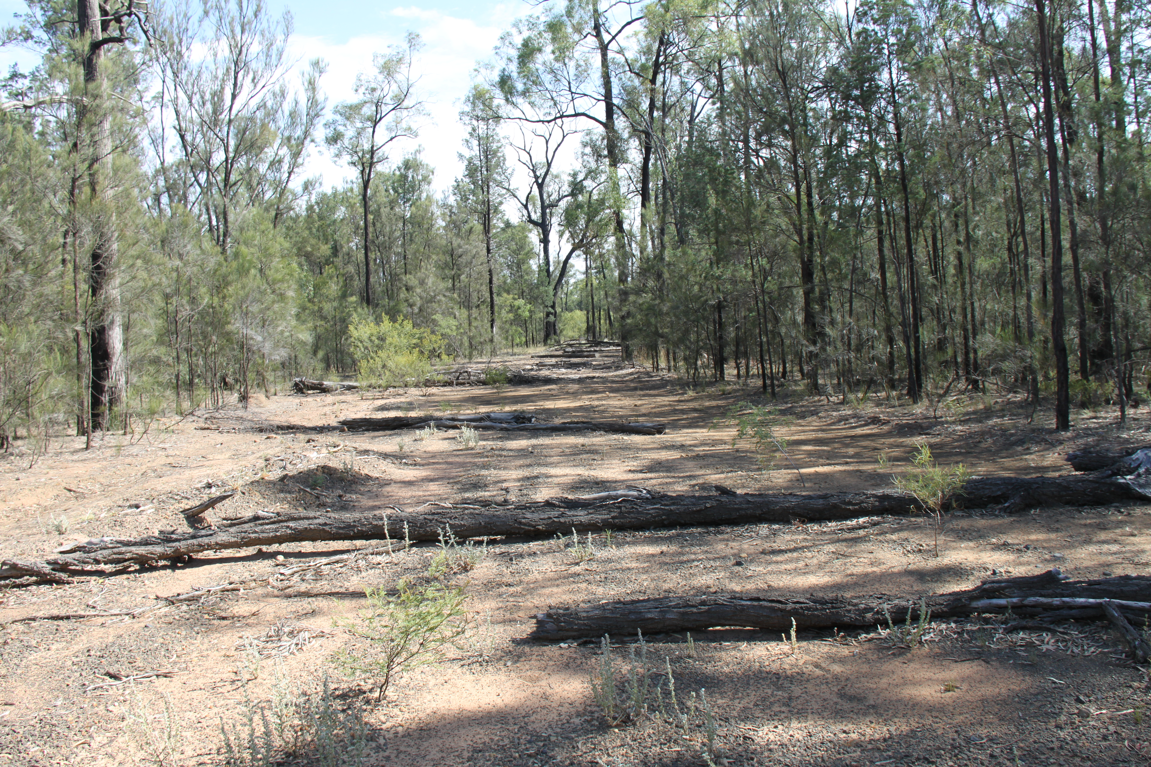

Further along Plumb Road to the west you will see a road with logs blocking vehicle access. You don’t have to walk far to see another spill site. Note wattle grows in these areas but little groundcover appears
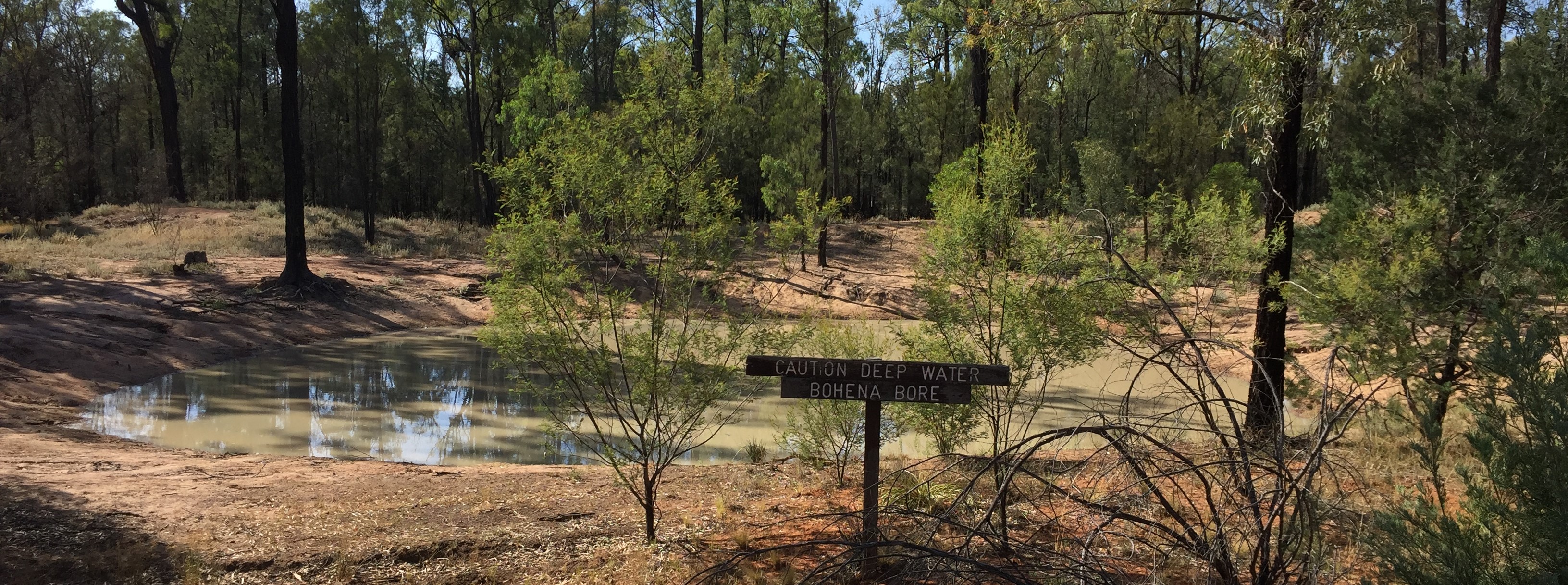
4. Government Water Monitoring Bore
GPS Location: 30°32’16.59”S 149°36’24.96”E
UTS: 750097.00 m E 6618723.98 m S
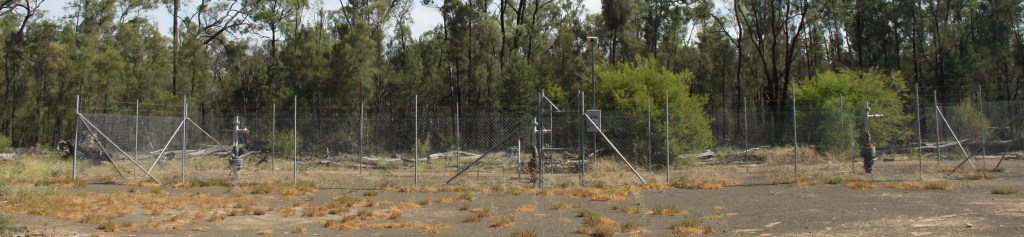
Three well heads surrounded by a high fence are located close to the road. The purpose of this water monitoring bore is to record baseline conditions for the area at three different depths but it is located between two fracked gas wells. Not a lot of data is publicly available at Water NSW and the gauges do not appear to be working.
5. Bohena 5 decommissioned gas well
GPS Location: 30°32’12.22”S 149°36’0.46”E
UTS: 749457.69 m E 6618861.14 m S
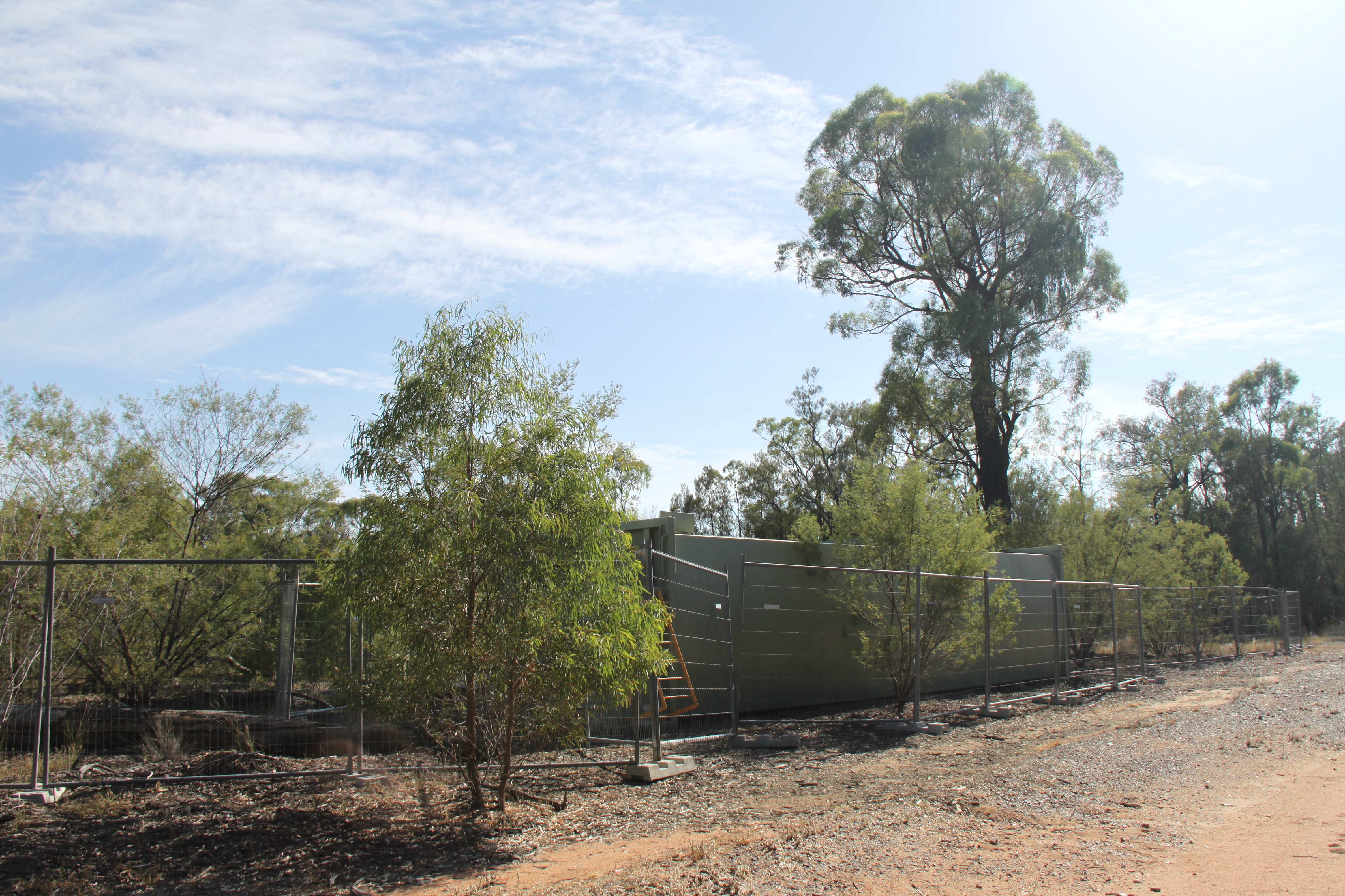
A fence surrounds a green water tank close to the road. Walk to the left around the fence to the back of the site to see green algae and the evidence of a spill. Galvanised burr, a native plant, is prevalent at this site. It is regarded as a weed because it contaminates wool, is not eaten by livestock, and competes with food providing plants.
Pilliga Forest Way
From Plumb Road turn northeast into Pilliga Forest Way.
6. Bohena 2 decommissioned gas well
GPS Location: 30°31’42.24”S 149°36’39.98”E
UTS: 750532.45 m E 6619760.23 m S

A dam, green water tank and rehabilitation area are near the road. The spill site goes into the forest for at least a kilometre. The deep dam is the overflow from the Bohena bore.
7. Gas pipeline crossing
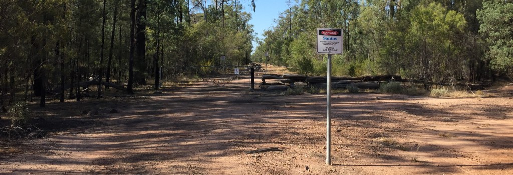
Near the Newell Highway gates block off vehicle access over the gas pipeline.
