Coonabarabran to Narrabri OR Narrabri and back
Reverse for Narrabri to Coonabarabran
No signs against coal seam gas can be seen on the Newell Highway between Coonabarabran and Narrabri because Santos removes them as soon as they go up.
1. Bibblewindi West Production Well 22 – 4WD only
GPS Location: 30°37’27.89”S 149°36’21.80”E
UTS: 749903.00 m E 6609109.00 m S
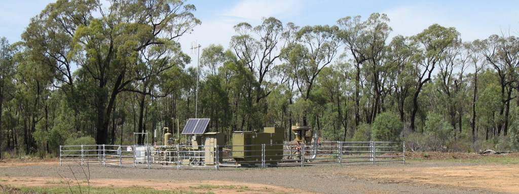
Newell Highway turn east onto X Line Rd, then 2.2km to Blue Nobby Road, turn left. Drive until a producing well and a locked gate is on your right. Locked gates have been installed on either side of Blue Nobby Road. The pipeline and unenforceable signage are designed to deter visitors.
2. Bohena Creek Crossing – 4WD only
GPS Location: 30°38’16.30”S 149°36’45.89”E
UTS: 750408.31 m E 6607620.17 m S
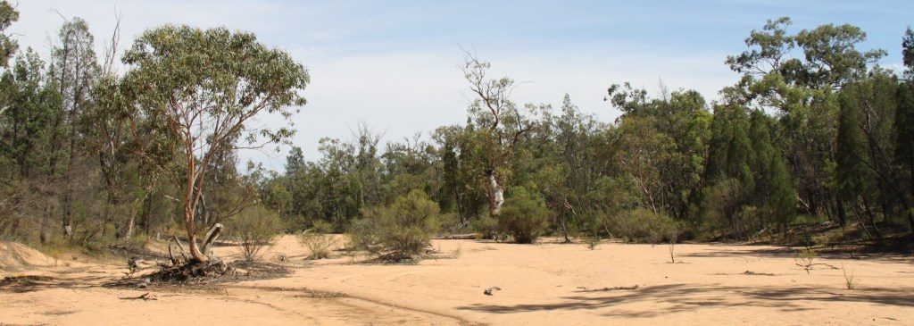
Newell Highway turn east into X Line Road. The first creek crossing has lots of trees in it, the second is the best place to stop. Turn off the engine and listen for activity or have a picnic. You can view flood flow piled up against creek depth markers.
3. Bibblewindi Water Treatment Plant – 4WD only
GPS Location: 30°38’0.72”S 149°38’53.70”E
UTS: 753823.48 m E 6608020.24 m S
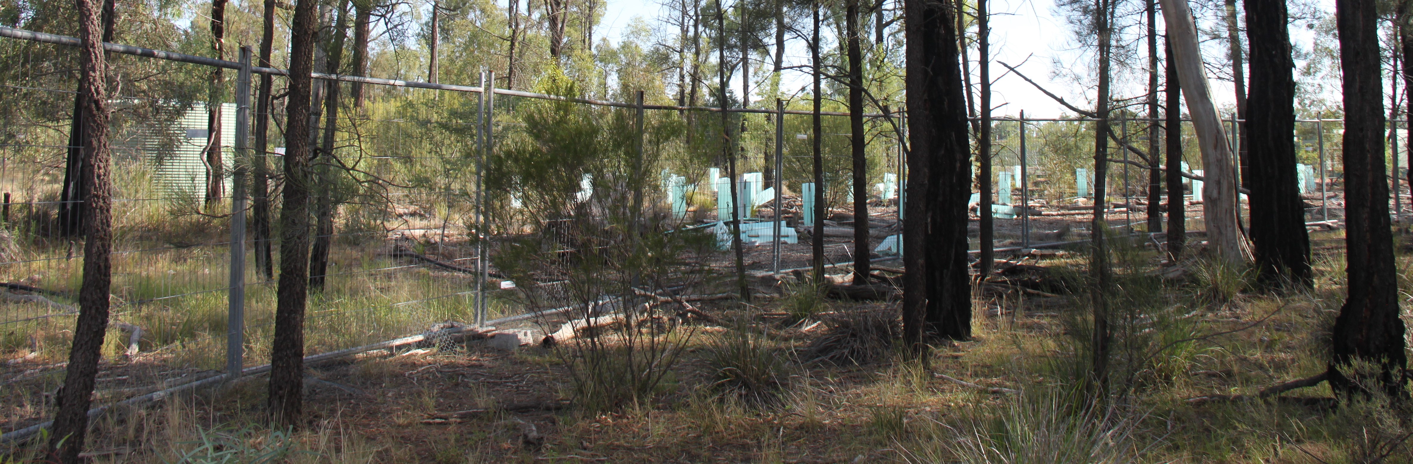
 Newell Highway turn east onto X Line Rd and travel 6.5km, turn left onto Garlands Rd, drive along till you come to the pipeline crossing with a locked gate and a no walking sign. You will see a fenced off rehabilitation area in the distance. Walk to the left of the pipeline until you come to the fenced spill site, then keep following the fence around until you see the banks of a legacy pond. Keep following the fence until you see a large tank, compressor, flare and other water/gas gathering infrastructure.
4. Plumb Road and Forest Way spill sites and government monitoring bore (also Pilliga Quick Gas Tour)
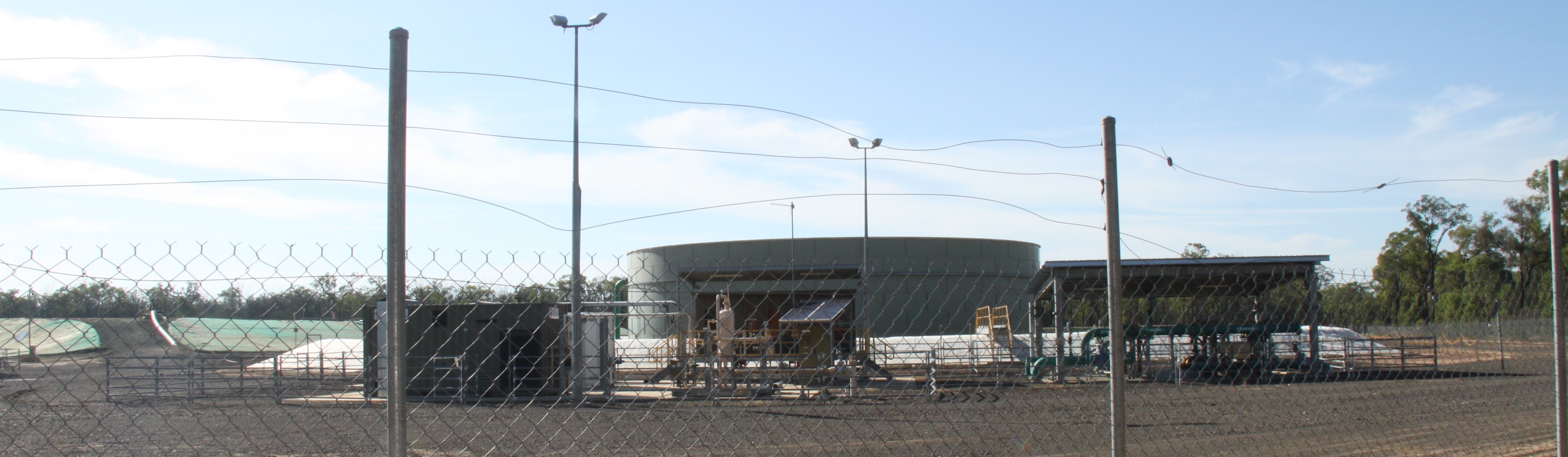
5. Santos Leewood Water Treatment Facility
From the Newell Highway follow the signs to Yarrie Lake and break for a picnic there, then on to the CSIRO Telescopes.
6. Wilga Park Power Station
GPS Location: 30°21’47.26”S 149°40’38.12”E
UTS: 757315.86 m E 6637935.75 m S
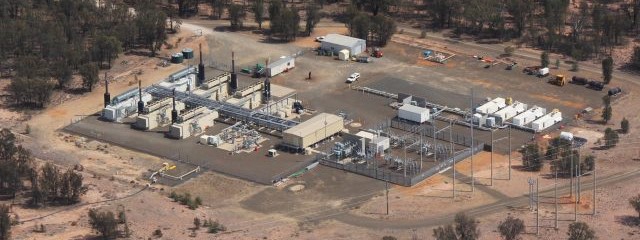
From Yarrie Lake Road, turn south on to Kiandool Lane. This gas fired power plant is on private property and is difficult to see much from the road except a flare and gas well. Looking east you can see the embankment of the waste water ponds and behind the tree line is the power station. Mostly unsealed roads in this area.
7. Santos Operations Centre
300 Yarrie Lake Road, Narrabri GPS Location: 30°20’13.14”S
149°43’52.87”E UTS: 762558.32 m E 6640715.00 m S
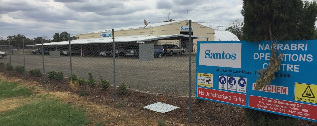
Santos control their operations and store equipment at his site. You can pull off the road safely here.
Report to NSW Environmental Protection Authority (EPA) anything you see in the Pilliga Forest that doesn’t look right. EPA’s Environment Line 24/7 Phone: 131 555. Follow up with an email to <info@epa.nsw.gov.au>
